Purva Kensho Hills Location
A key element of real estate investing is a strategic location, an indisputable pivot that can mean the difference between success and failure. Knowing that convenience is a highly valued feature, astute investors carefully evaluate a property's closeness to necessary services. S. Medihalli is one such locality in East Bangalore that has easy access to all the basic amenities.
Purva Kensho Hills is located at S. Medihalli, Attibele-Sarjapur Main Road, East Bengaluru. Its proximity to thriving employment centres has resulted in an influx of IT professionals, creating a surge in demand for new properties and rental units.
Address

Purva Kensho Hills' address is S. Medihalli, offering residents easy access to major IT hubs, educational institutions, healthcare facilities, and entertainment zones. The project's immediacy to the Outer Ring Road ensures seamless connectivity to every corner of Bangalore, making it an ideal choice for those seeking a central yet tranquil living experience.
Connectivity
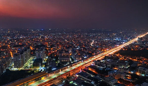
Connectivity suggests a system of streets with multiple routes and connections serving the same origins and destinations. It relates not only to the number of intersections along a segment of a street but also to how the transportation system connects an entire area. As connectivity increases, travel distances decrease drastically as the route options increase, allowing more direct travel between destinations and creating a more accessible and resilient system.
Purva Kensho Hills is strategically located on S. Medihalli in East Bangalore, which allows residents easy access to other parts of the city. Seamless integration with local transportation networks allows smoother transfers between different modes of transportation, making journeys more convenient for the residents.
Air Connectivity
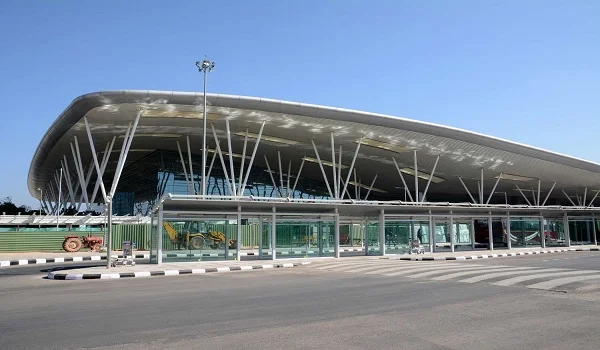
Residents of Purva Kensho Hills may easily connect to the airport because Kempegowda International Airport through NH 44 and SH 35 is situated in the same zone as the project. The airport serves as their primary transportation hub for travellers going anywhere in the world.
- Kempegowda International Airport – 56 km
Metro Connectivity
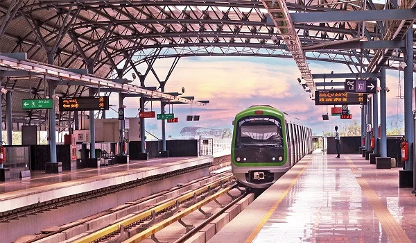
The Namma Metro Yellow Line's development has advanced steadily. Only 13 km from the project is Bommasandra, where the Yellow Line metro links from the Central Silk Board. Thanks to the metro, travelling to other areas of the city will be simpler and take less time for the residents of Purva Kensho Hills.
- Bommasandra Metro Station – 13 km
Rail Connectivity
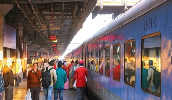
The project's location facilitates simple access by being near several of the city's major train terminals. Railway services lessen traffic congestion. Facilitating the boarding of trains for interstate travel at less crowded railway stops helps reduce the impact of transportation on the environment.
- Hosur Railway Station – 28 kmm
- Bengaluru Railway Station – 25 km
Road Connectivity
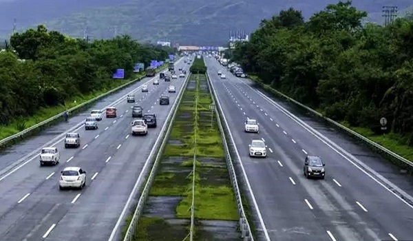
The project location connects to the city's major arterial roads and highways. Taking public transportation and sharing taxis saves money and helps preserve the environment by lowering traffic in the city.
- Sarjapur – Attibele Road
- NH 44
- SH 35
Places to visit near Purva Kensho Hills
Attibele Krishna Sagara Lake
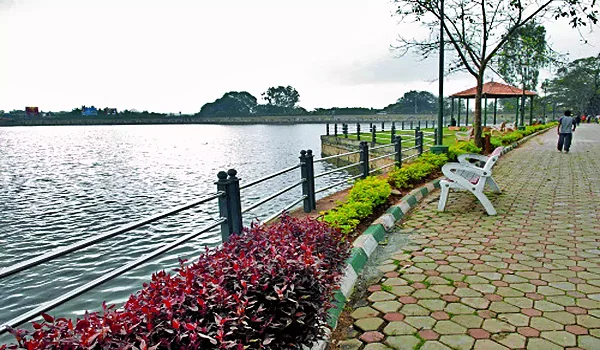
Situated in Bangalore close to Attibele, Attibele Krishnasagara Lake boasts tranquil surroundings. This large, lovely lake is the ideal getaway for those who love the outdoors and the stunning scenery that surrounds it. With its beautiful surroundings, the lake provides a tranquil sanctuary from the rush of daily life.
Lalbagh Botanical Garden
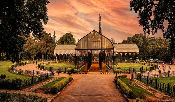
One of Bengaluru's main attractions is Lalbagh. The largest tropical and subtropical flora in India is found in Lalbagh, a vast garden spanning 240 acres in the city's centre, home to several centuries-old trees.
Surrealistic displays like Snow White and the Seven Dwarfs, a topiary park, a massive lake, and an exquisite glasshouse modelled after London's Crystal Palace adorn the park. Perched atop a rocky outcrop that dates back 3000 million years, a watchtower built by Kempegowda, the founder of Bengaluru, is recognized as a National Geological Monument. Other elements enhance the beautiful garden.
Bangalore Palace
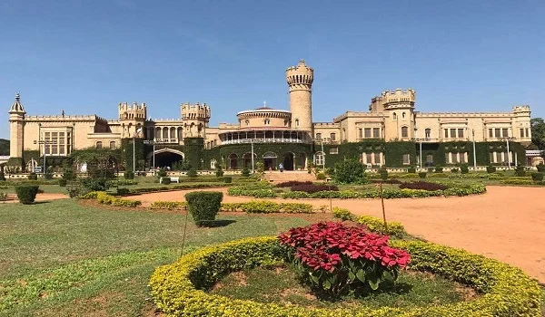
Inspired by Windsor Castle in England, this majestic architectural masterpiece features arches, battlements, and turreted parapets. Events such as concerts, exhibitions, and cultural events might occur in an open courtyard. Inside the palace edifice, exquisite carvings, paintings, and photos of maharajas, viceroys, and other notable figures provide unique attractions. Fun World, a theme park, is located inside the palace complex.
The main features of the palace are its 45,000 sq. ft. building on a 454-acre campus, 34 bedrooms with a swimming pool, exquisite interiors with wooden motifs, paintings, and carvings, a well- maintained exterior with greenery covering part of the palace walls, wooden fans, and imported artefacts.
Bannerghatta National Park
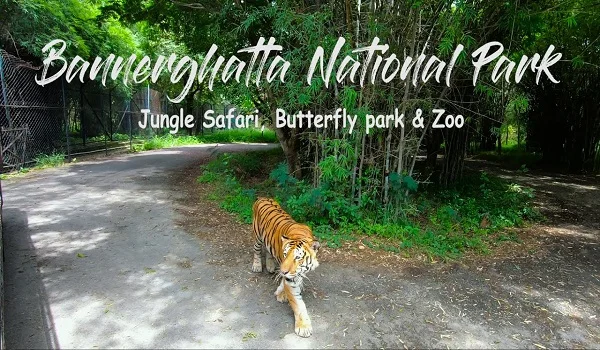
The Bannerghatta National Park, which covers 260.51 sq. km, is home to a lion and tiger safari featuring enclosures that mimic the animals' native habitats. You may get up close and personal with the enormous cats from here. In addition, there's a zoo, a nature camp for kids, a snake park, and a butterfly park.
There are 33 tigers in the park, including 7 white tigers. Three groups of tigers are kept; two relax in their individual enclosures, and the third is released for public viewing in the reserve forest. Bannerghatta National Park has a dedicated butterfly park. It comprises a 7.5-acre butterfly garden, a butterfly conservatory, a museum, a research lab, and a gift store. The butterfly park is home to 48 different species of butterflies.
Nadaprabhu Kempegowda Statue – 17 km
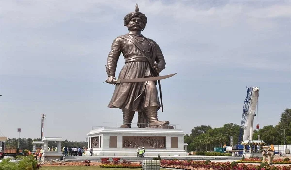
The Nadaprabhu Kempegowda Statue, located at the Kempegowda International Airport in Devanahalli, honors Bangalore's founder. It is known as the Statue of Prosperity. This incredible sculpture earned a place in the World Book of Records as the tallest bronze statue created in honour of a municipal founder. Visitors can see the statue of this historical person. The esteemed Prime Minister of India, Sri Narendra Modi, dedicated the statue.
Ram V Sutar, who previously curated the Statue of Unity, designed and sculpted the statue. 120 tons of steel and 98 tonnes of bronze go into creating the "Statue of Prosperity." At 108 feet, it represents his idea of a global city.
Nandi Hills – 50 km
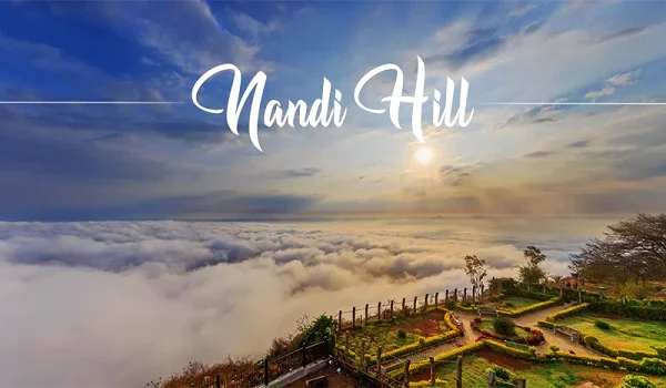
The well-liked tourist spot Nandi Hills is almost 50 km from Budigere Cross. This popular hill station has amazing views of the surrounding area, making it a great place for a day trip or weekend getaway. One can walk via the open woodland trails to reach the summit and relish the breathtaking view of the vast area.
According to conventional belief, the Ponnaiyar, Arkavathy, Papagni, Palar, and Penna rivers all have their source in the hills. Tourists love to watch the sunrise in Nandi Hills. In 1986, India hosted the first-ever SAARC summit at Nandi Hills.
Hogenakkal Water Falls
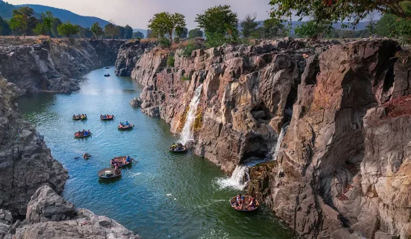
The Cauvery River enters Tamil Nadu near Hogenakal, where it flows into a large river with cascading water that appears to be a natural fall. Hogenakal is derived from the Kannada word for "Smoky Rocks." When it falls on the rock below, the rushing force of water from the river looks like smoke coming from the rocks.
The lake at Hogenakal stretches out for miles, making it possible to go country boating (PARISAL) on these waters. A Parisian ride will provide an unforgettable experience. Hogenakal, surrounded by hills of varying elevations, provides guests with a unique atmosphere and revitalizing relaxation. It was also possible to bathe in the falls. Getting an oil massage from a native is a unique experience.
S. Medihalli
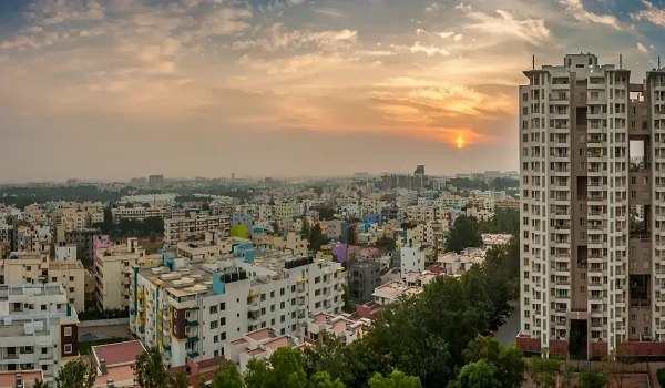
S. Medihalli is a prominent neighbourhood in East Bangalore connected to numerous important Bangalore neighbourhoods. It is quickly growing in all directions and becoming the city's newest residential and commercial centre. The setting provides the perfect blend of well-designed public spaces and well-organized infrastructure.
Sarjapur and Attibele main road is ideally situated amid verdant surroundings, although it is still reasonably accessible to the city's attractions. The route has seen significant construction in the last few years. The fast urbanization that resulted from the growth of surrounding areas like Varthur, Marathahalli, and Whitefield attracted significant international schools, hospitals, and IT and Tech companies.
Increased accessibility to the location is due to the recently constructed metro line connecting Sarjapur and Hebbal and the well-developed highways. Travel times have improved thanks to several signal-free routes and the expansion of the Sarjapur Road and Sarjapur-Attibele Road.
S. Medihalli and its connectivity
S. Medihalli is a popular residential suburb in the city's Eastern part. The city's major thoroughfares, such as Electronic City, Whitefield, Madiwala, Koramangala, and Hosur Road, are all easily accessible from this area. Its proximity to tech organizations makes it a popular location for working professionals. The development of SEZs such as RGA Tech Park, Smartworks Vaishnavi Tech Park, Wipro Limited, and IndiQube the Fore again improves the demand for the locality.
Due to the abundance of resources, the area is attracting many potential investors, which is accelerating the growth of the real estate sector and resulting in some amazing residential property development by some of the top developers in the area.
Metro Connectivity
The Yellow Line metro is currently being built. It will run from R.V. Road to Bommasandra. Between the start and terminus, the route spans 18.2 km and comprises 16 elevated stations. It travels via Jayadeva Metro Station, Bangalore's largest exchange station, from which it can link to the future Pink Line metro. The construction delay has caused the Yellow Line metro, originally scheduled to open by the end of 2023, to open in April 2024.
Interchange stations in the Yellow Line metro are:
- Rashtriya Vidyalaya Road (Connects Green Line Metro)
- Jayadeva Hospital (Connects Pink Line Metro)
- Central Silk Board (Connects Blue Line Metro)
- KR Puram (Connects Purple Line Metro)
Road Connectivity
S. Medihalli has excellent road connectivity to all city areas via the main ring roads and minimal traffic congestion. The proximity and connectivity to major roads make the destination a most sought-after one.
- Sarjapur-Marathahalli Road links Koramangala to Sarjapur, providing access to the city centre.
- The Sarjapur-Marathahalli route connects important employment centres, including Bellandur, Varthur, Marathahalli, Whitefield, and Brookfield.
- Sarjapur-Attibele Road links Sarjapur to SH-35 and the southernmost areas of the city (Attibele, Anekal, and Hosur).
- NH-44 connects Attibele with Electronic City.
Air Connectivity
The needs of the city for aviation connectivity are satisfied by Kempegowda International Airport. Bangalore's economy was greatly boosted in 2008 when the Kempegowda airport opened close to Devanahalli, on the city's northern outskirts, and numerous IT enterprises and tech parks were constructed. Taxis are an easy way to get to the airport from the road through the SH-35 or NH-44 highways.
Educational Institutions near Purva Kensho Hills
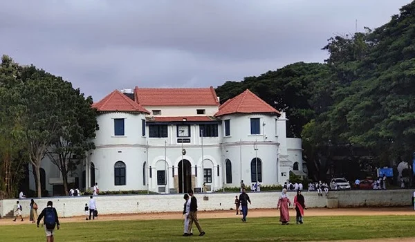
- Bishop Cotton Academy – 600 m
- Sprouts Academy International Pre-school – 3.6 km
- Aikyatha Public School – 4.9 km
- Sri Ram Public School – 5 km
- National School – 6.9 km
- Government High School – 7km
- Open Arms International School – 10 km
Hospitals near Purva Kensho Hills
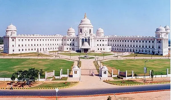
- Town Hospital – 4.8 km
- Satya Sai Hospital – 6.2 km
- Sri Chandra Sekara Hospital – 13.6 km
- Kauvery Hospital - 17 km
- Mazumdar Shaw Medical Centre – 17.1 km
Shopping Centres near Purva Kensho Hills

- Central Mall – 16.4 km
- Market Square Mall – 18 km
- Metro Mall – 20 km
- Brookfield Mall – 21 km
- Skyward Suns – 24 km
- Phoenix Market City – 26 km
- Green Field Hub – 26.3 km
Tech Parks near Purva Kensho Hills
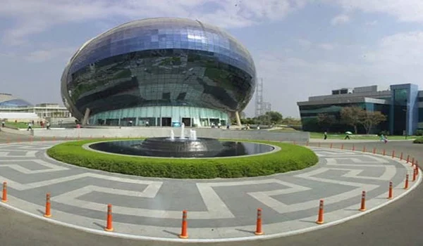
- Cheetah Tech Park – 7 km
- Sabic Technology Centre – 8.9 km
- Proposed Infosys Headquarters – 12 km
- Prathik Tech Park – 15 km
- ZED Tech Park -17.8 km
- PRI Tech Park SEZ – 18 km
- RGA Tech Park – 19 km
Frequently Asked Questions
1. What does the Purva Kensho Hills' location appear like?
S. Medihalli is a stunning neighbourhood with large lawns, lots of greenery, upscale apartment buildings, business establishments, and cafeterias. However, the property is in a highly sought-after area for investments because it is close to major IT hubs, schools, hospitals, and industrial zones.
2. Is there a metro service currently accessible close to the project location?
The project location is just 13 km from the Yellow Line metro station, which is scheduled to commence service in April 2024. In the future, it might reach Electronic City, shortening the distance.
3. Which main route leads to the Purva Kensho Hills in S. Medihalli?
Purva Kensho Hills connects the key roads of East Bangalore, including Sarjapur – Marathahalli Road, Bellandur, Varthur, and Sarjapur – Attibele Road, to provide convenient transportation between the city's important areas.
4. Which airport is close to Purva Kensho Hills?
The primary commercial airport serving Bangalore City is Kempegowda International Airport, located approximately 59 km from Purva Kensho Hills. Private aircraft can utilize Jakkur Airbase and HAL.
5. Which are the major IT hubs near the project location?
The project location provides easy access to major IT hubs such as Whitefield (20 km), Electronic City (20 km), Bellandur (22 km), Outer Ring Road (10 km), etc.